
Executive Development Programme in Conservation Geophysics Field Methods
This program equips executives with advanced field methods in conservation geophysics, enhancing strategic decision-making and resource management.
Executive Development Programme in Conservation Geophysics Field Methods
Programme Overview
The Executive Development Programme in Conservation Geophysics Field Methods is designed for professionals in the geophysics sector, including geoscientists, engineers, and project managers, who are looking to enhance their expertise in conservation geophysics for both research and practical applications. This program covers a comprehensive range of field methodologies, including magnetic surveys, seismic reflection, ground-penetrating radar, and electrical resistivity tomography, providing a deep understanding of how these techniques are used to assess and conserve cultural heritage sites and natural resources.
Participants will develop key skills in data acquisition, processing, and interpretation, as well as in the application of geophysical methods to solve specific challenges in the field. They will learn to design effective geophysical surveys, analyze data using advanced software tools, and interpret results to inform conservation strategies. The program also emphasizes the ethical considerations and legal frameworks surrounding the use of geophysics in conservation, ensuring that learners are well-prepared to work under professional and regulatory standards.
The career impact of this program is significant, offering participants the opportunity to advance in their current roles or transition into new positions that require specialized knowledge in conservation geophysics. Graduates will be well-equipped to lead interdisciplinary teams, develop innovative conservation projects, and contribute to the preservation of our cultural and natural heritage through advanced geophysical techniques.
What You'll Learn
The Executive Development Programme in Conservation Geophysics Field Methods is a comprehensive and advanced training initiative designed for professionals seeking to enhance their expertise in geophysical techniques for environmental conservation. This program equips participants with cutting-edge knowledge and practical skills in seismic, electromagnetic, and ground-penetrating radar methods. Key topics include advanced data acquisition, processing, and interpretation techniques, which are essential for identifying and assessing underground resources and structures without causing environmental disruption.
Through hands-on field exercises and real-world case studies, participants learn to apply these geophysical tools to address critical conservation challenges, such as detecting archaeological sites, mapping underground water sources, and monitoring geological hazards. Upon completion, graduates are well-prepared to lead projects that balance ecological sustainability with resource management, making significant contributions to conservation efforts and environmental stewardship.
Career opportunities for graduates are diverse, ranging from roles in environmental consultancy and government agencies to positions in academic research and non-profit organizations. This program not only advances personal and professional growth but also fosters a commitment to sustainable development and environmental protection.
Programme Highlights
Industry-Aligned Curriculum
Developed with industry leaders for job-ready skills valued by employers worldwide.
Globally Recognised Certificate
Recognised by employers across 180+ countries as a mark of professional excellence.
Flexible Online Learning
Study at your own pace with lifetime access to all course materials and updates.
Instant Access
Start learning immediately — no application process or waiting period required.
Constantly Updated Content
Stay ahead with the latest industry trends, best practices, and emerging insights.
Career Advancement
87% of graduates report measurable career progression within 6 months of completion.
Topics Covered
- 1. Introduction to Geophysics and Conservation: Learners will study the basics of geophysical principles and their applications in conservation, gaining an understanding of how geophysical methods can be used to protect and preserve cultural heritage sites.
- 2. Earth Materials and Their Geophysical Properties: This module covers the physical properties of earth materials and how these properties affect geophysical measurements, providing learners with the knowledge to interpret geophysical data accurately.
- 3. Electrical Methods in Geophysics: Learners will explore how electrical resistivity and induced polarization methods are used to detect and map subsurface features, essential for assessing the integrity of archaeological sites.
- 4. Magnetic Methods for Geophysical Surveying: This module focuses on the use of magnetic methods to identify and map ferromagnetic objects, such as metal artifacts or past structures, buried in the ground.
- 5. Ground Penetrating Radar Techniques: Learners will learn about the principles and applications of ground penetrating radar (GPR) for non-invasive subsurface imaging, enabling detailed mapping of buried structures and materials.
- 6. Seismic Methods in Archaeological Prospection: This module introduces learners to the use of seismic methods to study the subsurface, including reflection and refraction techniques for understanding stratigraphy and identifying buried archaeological features.
- 7. Data Acquisition and Processing Techniques: Learners will gain hands-on experience in setting up and conducting geophysical surveys, followed by data processing and analysis using industry-standard software.
- 8. Geophysical Data Interpretation and Reporting: This module covers the interpretation of geophysical data and the preparation of professional reports, essential skills for communicating findings to stakeholders in conservation projects.
- 9. Advanced Geophysical Techniques for Complex Sites: Learners will study advanced methods and techniques for investigating complex archaeological sites, including multi-method approaches and the integration of geophysical data with other types of evidence.
- 10. Case Studies in Conservation Geophysics: Through real-world case studies, learners will apply their knowledge and skills to solve practical conservation challenges, enhancing their ability to manage and preserve cultural heritage sites effectively.
What You Get When You Enroll
Secure checkout • Instant access • Certificate included
Key Facts
Audience: Conservationists, geophysicists, environmental scientists
Prerequisites: Basic geophysics knowledge, fieldwork experience
Outcomes: Proficient in practical geophysics, enhanced conservation skills
Ready to get started?
Join thousands of professionals who already took the next step. Enroll now and get instant access.
Enroll Now — $199Why This Course
Enhanced Technical Expertise: Enrolling in the 'Executive Development Programme in Conservation Geophysics Field Methods' equips professionals with advanced knowledge in geophysical techniques such as seismic, electromagnetic, and ground-penetrating radar. This deepens their understanding of how to accurately map and assess underground structures, which is crucial for site investigations in archaeology, urban development, and environmental hazard assessment.
Career Advancement Opportunities: The program offers networking opportunities with leading experts and industry leaders, facilitating connections that can lead to new job prospects or promotions. Graduates often have a competitive edge in the job market due to the specialized skills acquired, making them valuable assets in forward-thinking organizations that prioritize innovative geophysical solutions.
Comprehensive Skill Set: The curriculum covers not only technical aspects but also project management, data interpretation, and ethical considerations in fieldwork. This holistic approach prepares professionals to handle complex projects effectively, from planning and execution to analysis and reporting, thereby enhancing their overall job performance and employability.
Your Path to Certification
Trusted by Professionals Worldwide
Course Brochure
Download our comprehensive course brochure with all details
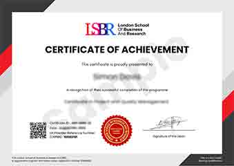
Sample Certificate
Preview the certificate you'll receive upon successful completion of this program.
Get Free Course Info
Enter your details and we'll send you a comprehensive course information pack straight to your inbox.
Employer Sponsored Training
Let your employer invest in your professional development. Request a corporate invoice and get your training funded.
Request Corporate InvoiceWhat People Say About Us
Hear from our students about their experience with the Executive Development Programme in Conservation Geophysics Field Methods at LSBRX - Executive Education.
James Thompson
United Kingdom"The course provided an in-depth understanding of conservation geophysics field methods, equipping me with practical skills that are directly applicable in the field. Gaining hands-on experience with various geophysical techniques has significantly enhanced my career prospects in environmental consulting."
James Thompson
United Kingdom"The Executive Development Programme in Conservation Geophysics Field Methods has significantly enhanced my understanding of practical geophysical techniques, making me more competitive in the job market. This program has not only equipped me with advanced skills but also provided real-world applications that are directly relevant to my field, paving the way for potential career growth."
Rahul Singh
India"The course structure was meticulously organized, providing a seamless transition from theoretical concepts to practical applications in conservation geophysics, which significantly enhanced my understanding and prepared me for real-world challenges."