
Executive Development Programme in Crisis Mapping: Geospatial Technologies for Response
This programme equips executives with geospatial technologies to enhance crisis mapping skills, improving response strategies and decision-making in emergencies.
Executive Development Programme in Crisis Mapping: Geospatial Technologies for Response
Programme Overview
The Executive Development Programme in Crisis Mapping: Geospatial Technologies for Response is a comprehensive, four-month initiative designed for mid-to-senior level professionals in the fields of humanitarian aid, urban planning, disaster management, and public policy. The programme equips participants with advanced skills in using geospatial technologies to enhance crisis response and resilience.
Participants will develop a robust understanding of geospatial data analysis, crisis mapping methodologies, and the integration of GIS (Geographic Information Systems) and remote sensing technologies. They will learn how to leverage satellite imagery, GPS, and other spatial data to support decision-making processes in crisis situations. The programme also emphasizes the importance of data visualization and communication to effectively convey critical information to stakeholders.
The programme has a significant career impact, enabling participants to lead more effective and strategic crisis management efforts. Graduates will be adept at deploying geospatial tools to improve response times, resource allocation, and community resilience. They will be well-prepared to take on leadership roles in organizations that require a deep understanding of geospatial technologies and their application in crisis scenarios.
What You'll Learn
The Executive Development Programme in Crisis Mapping: Geospatial Technologies for Response is an intensive, three-month course designed for professionals aiming to enhance their ability to respond effectively to global crises. This program combines cutting-edge geospatial technologies with strategic planning and crisis management techniques, equipping participants with the tools to analyze and visualize complex data in real-time. Key topics include Geographic Information Systems (GIS), satellite imagery analysis, and the integration of social media data for situational awareness.
Participants will learn to create and utilize crisis maps to guide decision-making, improve response strategies, and support humanitarian efforts. By the end of the program, graduates will be able to deploy these technologies in diverse settings, from natural disasters to conflict zones, ensuring more efficient and targeted interventions. The program’s practical focus on hands-on projects and case studies prepares graduates to lead teams and make data-driven decisions under pressure.
Career opportunities for program graduates are extensive, ranging from roles in international aid organizations, government agencies, and private sector firms to positions in academia and research. Graduates are well-positioned to advance in leadership roles, contributing to better crisis management and strategic planning. The program’s emphasis on ethical use of geospatial technologies ensures that graduates are not only adept but also responsible in their application.
Programme Highlights
Industry-Aligned Curriculum
Developed with industry leaders for job-ready skills valued by employers worldwide.
Globally Recognised Certificate
Recognised by employers across 180+ countries as a mark of professional excellence.
Flexible Online Learning
Study at your own pace with lifetime access to all course materials and updates.
Instant Access
Start learning immediately — no application process or waiting period required.
Constantly Updated Content
Stay ahead with the latest industry trends, best practices, and emerging insights.
Career Advancement
87% of graduates report measurable career progression within 6 months of completion.
Topics Covered
- 1. Introduction to Geospatial Technologies: Learners will be introduced to fundamental concepts of geospatial technologies, including maps, geographic information systems (GIS), and remote sensing. They will gain basic skills in interpreting geospatial data and using GIS software.
- 2. Crisis Mapping Fundamentals: This module covers the basics of crisis mapping, including its definition, importance, and applications. Learners will understand how crisis mapping can be used to support response efforts and will practice creating basic crisis maps.
- 3. Remote Sensing for Crisis Response: Learners will study the use of remote sensing techniques for identifying and analyzing crisis-related phenomena such as natural disasters and conflict zones. Practical skills in using satellite imagery and interpreting data will be developed.
- 4. GIS in Crisis Management: This module explores how GIS can be utilized in crisis management to coordinate response efforts, track resource distribution, and monitor the status of affected areas. Practical GIS exercises will be conducted to apply these concepts.
- 5. Data Collection and Management for Crisis Mapping: Learners will learn methods for collecting and managing geospatial data in crisis situations, including field data collection, data integration, and quality assurance. Practical exercises will focus on hands-on data management tasks.
- 6. Geospatial Analysis Techniques: This module covers advanced geospatial analysis techniques such as spatial statistics, pattern recognition, and overlay analysis. Learners will apply these techniques to real-world crisis scenarios to enhance their analytical skills.
- 7. Crisis Mapping Tools and Software: Learners will be introduced to various tools and software used in crisis mapping, including open-source GIS platforms and web mapping applications. They will practice using these tools to create and share crisis maps.
- 8. Ethical Considerations in Crisis Mapping: This module addresses ethical issues related to crisis mapping, including privacy concerns, data ownership, and the potential for misuse. Learners will engage in discussions and develop guidelines for ethical crisis mapping practices.
- 9. Case Studies in Crisis Mapping: Through in-depth case studies, learners will analyze real-world crisis mapping initiatives to understand their successes and challenges. This module aims to provide practical insights and lessons learned from crisis mapping projects.
- 10. Leadership and Strategic Planning in Crisis Mapping: This final module focuses on leadership and strategic planning for crisis mapping initiatives. Learners will develop skills in strategic planning, project management, and team leadership to effectively manage crisis mapping efforts.
What You Get When You Enroll
Secure checkout • Instant access • Certificate included
Key Facts
Audience: Crisis response professionals, geospatial analysts
Prerequisites: Basic computer skills, interest in GIS
Outcomes: Master crisis mapping techniques, enhance analytical skills
Ready to get started?
Join thousands of professionals who already took the next step. Enroll now and get instant access.
Enroll Now — $199Why This Course
Enhanced Geospatial Skills: Professionals in crisis management, humanitarian aid, and international development can significantly enhance their geospatial skills through this programme. Understanding how to use geospatial technologies can improve the accuracy and efficiency of response efforts, allowing for better allocation of resources and faster relief delivery in危机情况下,这种项目能够显著提升专业人士的空间技术技能。掌握如何使用空间技术可以提高响应工作的准确性和效率,从而更有效地分配资源和快速提供援助。
Strategic Response Planning: By participating in this programme, professionals can develop advanced strategies for response planning during crises. They will learn to use crisis mapping techniques to visualize and analyze complex data, enabling them to make informed decisions and craft effective crisis response strategies.例如,通过参与这个项目,专业人士可以学习如何使用危机制图技术来可视化和分析复杂数据,从而做出明智的决策并制定有效的危机应对策略。
Leadership and Team Coordination: This programme not only focuses on technical skills but also on leadership and team coordination. Participants will learn how to lead teams effectively and coordinate with various stakeholders, including government agencies, NGOs, and international organizations. This capability is crucial for successful crisis management, as it ensures that all parties work cohesively towards a common goal.此外,这个项目不仅注重技术技能,还注重领导力和团队协调能力的培养。参与者将学习如何有效领导团队,并与政府机构、非政府组织和国际组织等各方
Your Path to Certification
Trusted by Professionals Worldwide
Course Brochure
Download our comprehensive course brochure with all details
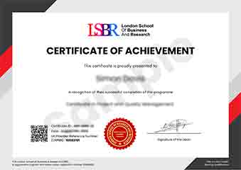
Sample Certificate
Preview the certificate you'll receive upon successful completion of this program.
Get Free Course Info
Enter your details and we'll send you a comprehensive course information pack straight to your inbox.
Employer Sponsored Training
Let your employer invest in your professional development. Request a corporate invoice and get your training funded.
Request Corporate InvoiceWhat People Say About Us
Hear from our students about their experience with the Executive Development Programme in Crisis Mapping: Geospatial Technologies for Response at LSBRX - Executive Education.
Charlotte Williams
United Kingdom"The course provided high-quality, detailed material on geospatial technologies, which significantly enhanced my ability to analyze and respond to crises. I gained practical skills that are directly applicable to real-world scenarios, making me more confident in my crisis mapping capabilities."
Mei Ling Wong
Singapore"This course has been instrumental in enhancing my ability to analyze and respond to crises using geospatial technologies, making my skills highly relevant in the current industry landscape. It has opened up new career opportunities and allowed me to contribute more effectively to humanitarian efforts."
Oliver Davies
United Kingdom"The course structure was meticulously organized, making complex concepts in crisis mapping accessible and easy to follow. The knowledge gained has been incredibly beneficial, providing a solid foundation in geospatial technologies and their real-world applications in response efforts."