
Executive Development Programme in Geologic Mapping for Natural Resources
This programme equips executives with advanced geologic mapping skills for strategic natural resource management and decision-making.
Executive Development Programme in Geologic Mapping for Natural Resources
Programme Overview
The Executive Development Programme in Geologic Mapping for Natural Resources is designed for senior-level geologists, geographers, resource managers, and policy makers aiming to enhance their expertise in advanced geologic mapping techniques and their applications in natural resources management. This program integrates cutting-edge methodologies and tools to address complex challenges in the exploration, assessment, and sustainable management of natural resources.
Participants will develop a deep understanding of geospatial data analysis, advanced geologic mapping technologies, and the integration of geological data with environmental and economic factors. Key skills include the use of Geographic Information Systems (GIS), remote sensing, and D modeling to interpret and visualize geologic structures and resources. The program also emphasizes strategic planning, risk assessment, and decision-making, equipping learners with the ability to inform policy and guide resource development initiatives.
This programme is instrumental in shaping the career trajectories of its participants by providing them with the knowledge and skills to lead in the development and implementation of geologic mapping strategies. Graduates are well-prepared to take on leadership roles in the natural resources sector, contributing to sustainable development, and driving innovation in geologic mapping and resource management.
What You'll Learn
The Executive Development Programme in Geologic Mapping for Natural Resources is designed to equip professionals with advanced skills in geologic mapping techniques, essential for exploring and managing natural resources efficiently. This comprehensive program combines theoretical knowledge with practical applications, ensuring that participants gain a deep understanding of geological processes and their impact on resource management.
Key topics include advanced geologic mapping methodologies, remote sensing technologies, GIS applications, and sustainable resource extraction practices. Participants will learn to interpret geological data, conduct field surveys, and analyze mineral deposits, all under the guidance of industry experts.
Upon completion, graduates will be well-prepared to apply these skills in various roles such as geological surveyors, resource managers, and environmental consultants. The program's focus on cutting-edge technologies and sustainable practices positions graduates for leadership roles in government agencies, mining companies, and environmental organizations. Alumni often find opportunities to contribute to projects that support sustainable development and resource conservation, making a tangible impact on the environment and the economy.
Programme Highlights
Industry-Aligned Curriculum
Developed with industry leaders for job-ready skills valued by employers worldwide.
Globally Recognised Certificate
Recognised by employers across 180+ countries as a mark of professional excellence.
Flexible Online Learning
Study at your own pace with lifetime access to all course materials and updates.
Instant Access
Start learning immediately — no application process or waiting period required.
Constantly Updated Content
Stay ahead with the latest industry trends, best practices, and emerging insights.
Career Advancement
87% of graduates report measurable career progression within 6 months of completion.
Topics Covered
- 1. Fundamentals of Geology: Learners will study basic geological principles and rock formations, learning to identify common rock types and understand geological time scales. They will gain foundational knowledge in field mapping techniques.
- 2. Geographic Information Systems (GIS) Basics: Learners will explore the use of GIS in natural resource management, including data collection, processing, and visualization. Practical skills include creating and interpreting maps and spatial data.
- 3. Advanced Field Mapping Techniques: This module covers advanced mapping techniques such as contouring, stratigraphic correlation, and use of GPS for precise location data. Learners will develop skills in detailed geological mapping in diverse terrains.
- 4. Remote Sensing for Geologic Mapping: Learners will study the application of remote sensing technologies in geologic mapping, including satellite imagery and aerial photography. Practical skills include interpreting remote sensing data to identify geological features.
- 5. Geological Hazards Assessment: This module focuses on understanding and assessing geological hazards such as landslides and earthquakes. Learners will learn to use geologic mapping to predict and mitigate risks.
- 6. Mineral Resource Exploration Techniques: Learners will study various exploration methods for locating and assessing mineral resources, including geophysical surveys and geochemical sampling. Practical skills include interpreting geophysical and geochemical data.
- 7. Geostatistics in Resource Management: This module introduces geostatistical methods for resource estimation and prediction. Learners will apply statistical models to analyze spatial data and make informed decisions in resource management.
- 8. Environmental Impact Assessment (EIA): Learners will learn how to conduct EIA for natural resource projects, focusing on the environmental implications of geologic activities. Practical skills include preparing reports and making recommendations for sustainable practices.
- 9. Case Studies in Geologic Mapping: This module involves in-depth analysis of case studies from real-world geologic mapping projects. Learners will apply theoretical knowledge to solve practical problems in natural resource management.
- 10. Leadership and Communication in the Geosciences: Learners will develop leadership and communication skills essential for managing geologic mapping projects. Practical skills include presenting findings, leading teams, and negotiating with stakeholders.
What You Get When You Enroll
Secure checkout • Instant access • Certificate included
Key Facts
Targeted at geologists and resource managers
No prior mapping experience required
Enhances skills in geological data analysis
Improves proficiency in geologic mapping techniques
Develops strategic resource planning abilities
Increases understanding of geological surveying
Ready to get started?
Join thousands of professionals who already took the next step. Enroll now and get instant access.
Enroll Now — $199Why This Course
Enhance Technical Expertise: Engaging in an Executive Development Programme in Geologic Mapping for Natural Resources can significantly enhance professionals' technical skills. This program covers advanced techniques and tools used in geologic mapping, such as Geographic Information Systems (GIS) and remote sensing technologies, which are crucial for modern resource management.
Career Advancement: This program not only equips professionals with the latest technologies but also provides strategic insights into the natural resources sector. Graduates often find themselves in leadership roles as they bring a blend of technical knowledge and business acumen, making them valuable assets to their organizations.
Networking Opportunities: Participating in such a program offers a platform to connect with industry experts, academics, and peers. These networks can lead to collaborative projects, mentorship opportunities, and valuable career connections that can open doors to new job opportunities and partnerships.
Strategic Thinking: The program emphasizes the importance of strategic planning and decision-making in the context of natural resources. Professionals learn to apply these skills to formulate and implement sustainable resource management strategies, which is increasingly important as the sector faces challenges like climate change and resource depletion.
Your Path to Certification
Trusted by Professionals Worldwide
Course Brochure
Download our comprehensive course brochure with all details
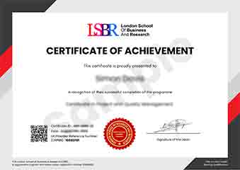
Sample Certificate
Preview the certificate you'll receive upon successful completion of this program.
Get Free Course Info
Enter your details and we'll send you a comprehensive course information pack straight to your inbox.
Employer Sponsored Training
Let your employer invest in your professional development. Request a corporate invoice and get your training funded.
Request Corporate InvoiceWhat People Say About Us
Hear from our students about their experience with the Executive Development Programme in Geologic Mapping for Natural Resources at LSBRX - Executive Education.
Charlotte Williams
United Kingdom"The course provided high-quality, detailed geologic mapping techniques that significantly enhanced my ability to analyze and interpret natural resource data. Gaining hands-on experience in the field and through advanced software tools has been invaluable for my career in resource management."
Brandon Wilson
United States"This course has been incredibly valuable, equipping me with advanced geologic mapping techniques that are directly applicable in the field. It has not only enhanced my technical skills but also opened up new opportunities for career advancement in natural resource management."
Arjun Patel
India"The course structure was meticulously organized, providing a seamless transition from theoretical concepts to practical applications in geologic mapping, which greatly enhanced my understanding and prepared me for real-world challenges in natural resource management."