
Executive Development Programme in Real-Time 3D Mapping with Drone Data
This program equips executives with advanced skills in real-time 3D mapping using drone data, enhancing decision-making and operational efficiency.
Executive Development Programme in Real-Time 3D Mapping with Drone Data
Programme Overview
The 'Executive Development Programme in Real-Time D Mapping with Drone Data' targets professionals eager to harness innovative drone technology. Engineers, surveyors, and GIS specialists will find this course particularly useful.
First, participants will learn to operate drones for data collection. Next, they will delve into real-time D mapping techniques. Finally, they will explore practical applications in various industries. By the end, attendees will possess advanced skills in drone operation and D mapping. This enables them to enhance their projects and drive innovation in their organizations.
What You'll Learn
Unlock the skies and transform your career in the cutting-edge field of real-time D mapping with drone data! This Executive Development Programme propels you into the future of geospatial technology. You will dive into the dynamic world of drones and D mapping. Start by mastering drone operations and data collection. Next, learn to process and analyze this data. Finally, create stunning, real-time D maps. Moreover, gain hands-on experience with industry-leading software. Meanwhile, collaborate with experts and peers.
Why enroll?
Firstly, stand out in a rapidly growing job market. Secondly, boost your earning potential. Thirdly, contribute to innovative projects in fields like urban planning, environmental monitoring, and infrastructure management. Furthermore, network with industry leaders and gain a competitive edge.
Unleash your potential. Join us and soar to new heights in your career!
Programme Highlights
Industry-Aligned Curriculum
Developed with industry leaders for job-ready skills valued by employers worldwide.
Globally Recognised Certificate
Recognised by employers across 180+ countries as a mark of professional excellence.
Flexible Online Learning
Study at your own pace with lifetime access to all course materials and updates.
Instant Access
Start learning immediately — no application process or waiting period required.
Constantly Updated Content
Stay ahead with the latest industry trends, best practices, and emerging insights.
Career Advancement
87% of graduates report measurable career progression within 6 months of completion.
Topics Covered
- Drone Technology Fundamentals: Introduction to drone components and basic flight principles.
- Aerial Photography and Videography: Techniques for capturing high-quality images and videos with drones.
- Data Processing and GIS Integration: Methods for processing drone data and integrating it with Geographic Information Systems.
- 3D Modeling and Mapping Techniques: Creating accurate 3D models and maps from drone-collected data.
- Real-Time Data Analysis and Visualization: Tools and methods for real-time analysis and visualization of drone data.
- Project Management and Case Studies: Managing drone mapping projects and learning from real-world case studies.
What You Get When You Enroll
Secure checkout • Instant access • Certificate included
Key Facts
Audience
Designed for professionals transitioning into D mapping
Also, suitable for drone pilots seeking new skills
First timers welcome
Prerequisites
Basic computer skills needed
No prior drone experience required
Also, bring a willingness to learn
Outcomes
Gain hands-on experience with drone technology
First, learn to operate drones safely
Then, create real-time D maps
Finally, apply skills to various industries
Ultimately, enhance your professional portfolio
Ready to get started?
Join thousands of professionals who already took the next step. Enroll now and get instant access.
Enroll Now — $199Why This Course
Hands-On Learning: First, you'll actively engage in real-time D mapping. You go beyond theory, starting in the field. For example, you'll be using drones to gather data. Then, you interpret that data and create D maps.
Industry-Relevant Skills: Secondly, you'll gain skills that industries value. You'll learn to use software that professionals use every day. Furthermore, you'll understand how to manage and analyze data from drones. This makes you more competitive in the job market.
Networking Opportunities: Finally, you'll connect with like-minded individuals. You'll collaborate with peers on projects. You will also meet industry experts who can offer mentorship.
Your Path to Certification
Trusted by Professionals Worldwide
Course Brochure
Download our comprehensive course brochure with all details
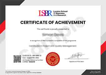
Sample Certificate
Preview the certificate you'll receive upon successful completion of this program.
Get Free Course Info
Enter your details and we'll send you a comprehensive course information pack straight to your inbox.
Employer Sponsored Training
Let your employer invest in your professional development. Request a corporate invoice and get your training funded.
Request Corporate InvoiceWhat People Say About Us
Hear from our students about their experience with the Executive Development Programme in Real-Time 3D Mapping with Drone Data at LSBRX - Executive Education.
James Thompson
United Kingdom"The course content was incredibly comprehensive, covering everything from the basics of drone technology to advanced 3D mapping techniques. I gained practical skills that I can immediately apply in my current role, such as data processing and analysis, which has already proven beneficial in my projects."
Ahmad Rahman
Malaysia"The Executive Development Programme in Real-Time 3D Mapping with Drone Data has been instrumental in enhancing my technical proficiency and industry relevance, allowing me to implement cutting-edge 3D mapping techniques in my current role, which has significantly boosted my career advancement prospects. The practical applications I learned have directly translated into improved project outcomes and increased efficiency in my daily tasks."
Arjun Patel
India"The course structure was incredibly well-organized, with each module building seamlessly on the previous one, making complex topics in real-time 3D mapping accessible. The comprehensive content, particularly the real-world applications of drone data, has significantly enhanced my professional skills and given me a competitive edge in the industry."